
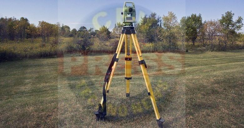
Leveling is a branch of surveying in civil engineering to measure levels of different points with respect to a fixed point such as elevation of a building, height of one point from ground, etc. Leveling is the most widely used method for obtaining this elevation of ground points relative as a reference datum & is usually carried out as a separate procedure from that used for fixing a planimetric position. Leveling involves the measurement of a vertical distance relative to a horizontal line of sight. Therefore it requires a graduated staff for the vertical measurements and an instrument that will provide a horizontal line of sight.
TYPES OF LEVELING:
1. Direct Leveling:
It is the most commonly used method of leveling. In this method, measurements are observed directly from leveling instrument. Based on the observation points and instrument positions direct leveling is divided into different types as follows:
I. Simple leveling
II. Differential leveling
III. Fly leveling
IV. Profile leveling
V. Precise leveling
VI. Reciprocal leveling
I. Simple Leveling
It is a simple and basic form of leveling in which the leveling instrument is placed between the points which elevation is to be find. Leveling rods are placed at that point and sighted through leveling instrument. It is performed only when the points are nearer to each other without any obstacles.
II. Differential Leveling
Differential leveling is performed when the distance between two points is more. In this process, a number of inter stations are located and the instrument is shifted to each station and observed the elevation of inter-station points. Finally, the difference between the original two points is determined.
III. Fly Leveling
Fly leveling is conducted when the benchmark is very far from the workstation. In such a case, a temporary benchmark is located at the work station which is located based on the original benchmark. Even it is not highly precise it is used for determining approximate levels.
IV. Profile Leveling
Profile leveling is generally adopted to find elevation of points along a line such as for road, rails or rivers etc. In this case, readings of intermediate stations are taken and a reduced level of each station is found.
V. Precise Leveling
Precise leveling is similar to differential leveling but in this case, higher precision is wanted. To achieve high precise, serious observation procedure is performed. The accuracy of 1 mm per 1 km is achieved.
VI. Reciprocal Leveling
When it is not possible to locate the leveling instrument in between the intervisible points, reciprocal leveling is performed. This case appears in the case of ponds or rivers etc. in the case of reciprocal leveling, the instrument is set nearer to the 1st station and sighted towards the 2nd station.
2. Barometric Leveling:
Uses an instrument to measure the atmosphere at any altitude. So in this method of leveling, the atmospheric pressure of two different points is carefully observed, determining the base of the vertical difference between the points. However, civil engineers are only using this method rarely as it is only a rough estimation in the construction project.
3. Trigonometric Leveling:
It is a process of leveling which the point of elevation or measuring the difference between the points from observing the horizontal distances and vertical angles in the field is called trigonometric leveling. Because it uses trigonometric relation in this method in surveying, where the elevation of a point from horizontal distance and angle is determined, it is also known as indirect leveling.
4. Stadia Leveling:
This method is a modified form from the trigonometric leveling method in which, by using the Tacheometry principle, in determining the elevation of the point. In this surveying method, the line of sight is horizontally inclined, and it is more accurate and ideal in surveying hilly terrains.