SURVEYING AND DRAWING IN GEOLOGY: GEOLOGICAL MAPS AND CROSS-SECTIONS
Surveying and Drawing in Geology: Geological Maps and Cross-Sections
Introduction
Geology, the science of understanding the Earth’s structure and history, relies heavily on two fundamental tools: geological maps and cross-sections. These tools provide crucial information for researchers, engineers, and environmental professionals. In this article, we’ll explore the significance of geological maps and cross-sections, their key components, and the essential techniques for creating them.
Geological Maps: A Window to the Earth’s Past and Present
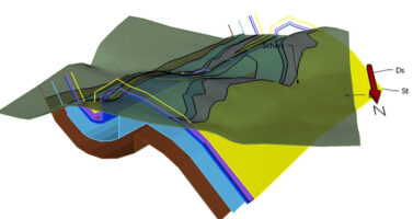
Geological maps are graphical representations of the Earth’s surface, showcasing the distribution and characteristics of different rock types, sediments, fossils, and geological structures. Here are the key points about geological maps:
- Rock Types and Formations: Geological maps illustrate the types and locations of rocks and sediments on the Earth’s surface. Different colors and symbols represent various rock formations.
- Stratigraphy: They display the relative ages of rock layers, allowing geologists to decipher the Earth’s history through stratigraphic correlations.

- Topography: Contour lines on the map provide information about the elevation and shape of the land surface, aiding in understanding the topographical features.
- Structural Geology: Geological maps reveal fault lines, folds, and other structural features that can impact engineering and environmental assessments.
- Mineral Resources: They help identify potential mineral resources and their distribution, essential for mining and resource management.
Creating Geological Maps
Creating geological maps involves a systematic approach and several essential steps:
- Fieldwork: Geologists conduct field surveys, collecting rock samples, observing outcrops, and recording data about the geological features.
- Data Interpretation: The collected data is interpreted to determine the types of rocks, their distribution, and the structural elements present.
- Cartography: Geologists use cartographic techniques to represent this information on a map, often employing specific symbols and colors to distinguish rock units.
- Compilation: Compilation of various data sources, including aerial photographs and remote sensing imagery, contributes to the accuracy of geological maps.
- Legend and Key: Every geological map includes a legend or key that explains the symbols and colors used to represent different geological features.
Cross-Sections: Peering Beneath the Surface
Cross-sections in geology are vertical or horizontal slices through the Earth’s crust that provide a 2D representation of subsurface geology. Key points about cross-sections include:
- Depth Profiling: Cross-sections offer insights into the Earth’s subsurface, including the depth and geometry of rock layers and structures.
- Stratigraphic Information: They reveal the order and relative ages of rock layers, helping geologists understand the geological history of an area.

- Engineering Applications: Cross-sections are vital for engineers when planning construction, as they provide information on potential hazards, such as faults or unstable rock layers.
- Environmental Impact Assessment: Environmental professionals use cross-sections to evaluate the impact of activities like mining or drilling on the subsurface environment.
Creating Geological Cross-Sections
The process of creating geological cross-sections involves the following steps:
- Data Collection: Geological data collected from boreholes, seismic surveys, and surface mapping is compiled for the area of interest.
- Profile Line Selection: Geologists choose the appropriate profile line for the cross-section, ensuring it intersects critical geological features.
- Interpolation: The data collected along the profile line are interpolated to create a continuous representation of subsurface geology.
- Drawing the Cross-Section: Geologists use specialized software or manual techniques to draw the cross-section, representing rock layers and structures accurately.
- Annotations: Annotations are added to provide context, such as depth scales, rock unit names, and structural information.
Conclusion
Geological maps and cross-sections are invaluable tools in the field of geology. They aid in understanding the Earth’s past and present, assist in resource management, and play a pivotal role in engineering and environmental assessments. The creation of these tools involves meticulous data collection, interpretation, and cartography, enabling geologists and other professionals to gain critical insights into the Earth’s subsurface. With these tools, the geological mysteries of the Earth continue to be unraveled, benefiting science and society as a whole.