A SURVEYOR’S TOOLKIT: INSTRUMENTS AND EQUIPMENT
A Surveyor’s Toolkit: Instruments and Equipment
Surveying is a crucial profession that plays a pivotal role in various industries, from construction and engineering to land development and environmental planning. Surveyors use a wide range of instruments and equipment to accurately measure and map the Earth’s surface. In this article, we will explore the key tools that make up a surveyor’s toolkit.
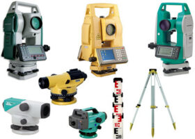
Theodolite
The theodolite is one of the most fundamental instruments in a surveyor’s toolkit. It is used for measuring horizontal and vertical angles with high precision. Theodolites come in both optical and electronic variants and are essential for tasks such as determining property boundaries and mapping topographical features.
Total Station
Total stations are advanced electronic instruments that combine the functionality of a theodolite with an electronic distance measurement (EDM) system. Surveyors use total stations to measure distances, angles, and coordinates with exceptional accuracy. These devices have revolutionized surveying by increasing efficiency and reducing errors.
GPS Receivers
Global Positioning System (GPS) receivers have become indispensable tools for modern surveyors. They use signals from satellites to determine precise positions on Earth’s surface. GPS technology has dramatically improved surveying accuracy and efficiency, especially for large-scale projects and geographic information systems (GIS).
Levels
Levels are used to measure height differences or elevations between points. Surveyors use various types of levels, including dumpy levels, digital levels, and laser levels, to determine the relative heights of objects, establish benchmarks, and ensure the proper slope of structures like roads and pipelines.
Measuring Tapes
Measuring tapes, ranging from traditional steel tapes to modern digital versions, are essential tools for measuring distances on the ground. They are used for tasks such as property boundary surveys, building layout, and land subdivision.
Prisms and Reflectors
Prisms and reflectors are used in conjunction with total stations to bounce measurement signals back to the instrument. This allows surveyors to measure distances to inaccessible points, such as the top of a hill or the center of a bridge, with high accuracy.
Surveying Tripods
Surveying tripods provide stable support for instruments like theodolites, total stations, and levels. They are designed to withstand rugged outdoor conditions and ensure that measurements are taken from a consistent height above the ground.
Data Collectors and Software
Modern surveyors rely on data collectors and software to record, process, and analyze survey data efficiently. These tools enable surveyors to perform complex calculations, generate accurate maps, and create digital representations of surveyed areas.
Safety Equipment
Safety is a top priority for surveyors working in the field. Personal protective equipment (PPE), including helmets, high-visibility clothing, and safety boots, is essential to protect against potential hazards on construction sites and in remote areas.
Environmental Monitoring Equipment
In certain surveying projects, environmental monitoring equipment may be used to assess factors like soil composition, groundwater levels, and air quality. This data helps ensure that construction and development activities comply with environmental regulations.
In conclusion, a surveyor’s toolkit is a diverse collection of instruments and equipment designed to measure and map the Earth’s surface accurately. From theodolites and total stations to GPS receivers and data collectors, these tools empower surveyors to gather precise data essential for various industries. As technology continues to advance, the surveying profession will likely see further innovations in equipment that enhance accuracy, efficiency, and safety in the field.