HISTORY OF LAND SURVEYING AND ITS EVOLUTION OVER TIME
Land surveying is a profession that has been around for centuries, dating back to ancient times. The practice involves measuring and mapping land, determining property boundaries, and creating accurate topographic maps. Throughout history, the tools and techniques used in land surveying have evolved significantly, from ancient tools such as the groma to modern equipment like Global Positioning Systems (GPS).
The Early Days of Land Surveying
The earliest forms of land surveying date back to ancient Egypt, where surveyors used the groma, a device consisting of a vertical staff with horizontal arms, to establish straight lines and right angles. In ancient Rome, surveyors used a similar device called a dioptra to measure angles and distances. Over time, surveying techniques spread to other parts of the world, including China and India.
The Renaissance and the Age of Exploration
During the Renaissance, surveying became more advanced as mapmaking became more important for navigation and exploration. Theodolites, a tool used for measuring angles and distances, were developed during this time, and advancements were made in trigonometry, which allowed for more precise measurements. As European explorers began to travel to other parts of the world, surveying played a crucial role in mapping new territories and establishing boundaries.
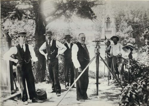
The Industrial Revolution and the Rise of Modern Surveying
The Industrial Revolution brought significant advancements in surveying technology, such as the development of the transit and stadia rod, which made it easier to measure distances accurately. The invention of the level allowed surveyors to determine elevation, making it possible to create detailed topographic maps. The advent of aerial photography in the early 20th century further revolutionized surveying, allowing for even more detailed mapping.
The Digital Age
The advent of computers and digital technology in the latter half of the 20th century brought about significant changes in surveying. The introduction of Global Positioning Systems (GPS) made it possible to pinpoint locations with incredible accuracy, and Geographic Information Systems (GIS) allowed for the creation of detailed digital maps. With the advent of digital technology, surveying became more efficient and precise, allowing for faster project completion times and more accurate results.
The Future of Land Surveying
As technology continues to advance, we can expect to see even more changes in the field of land surveying. Drones are already being used to survey large areas quickly and efficiently, and 3D laser scanning technology allows for even more precise mapping. The rise of machine learning and artificial intelligence is also likely to have an impact on land surveying, as these technologies can be used to analyze survey data and create even more detailed maps.
In conclusion, land surveying has a long and rich history, dating back to ancient times. Throughout the centuries, surveying techniques and tools have evolved significantly, from ancient devices like the groma to modern technology like GPS and GIS. As technology continues to advance, we can expect to see even more innovations in the field of land surveying, making it easier and more efficient than ever before.