GPS SURVEYING –ALL YOU NEED TO KNOW
Surveying has changed substantially over the years — what used to take months of observation, measurement and geometrical calculations now takes a few hours or days thanks to the introduction of GPS technology. In fact, the surveying industry was one of the first to utilize GPS technology, recognizing the potential benefits of the technology. Today, surveying professionals rely on GPS to provide accurate and reliable data for clients across a wide range of industries and applications. Despite the widespread usage of GPS technology in surveying, however, it’s not a topic many know about — that’s why we’re here to explain the GPS surveying basics.
GPS stands for global positioning system, and it uses signals from satellites to pinpoint a location on the Earth’s surface. In addition to transmitting information about location, GPS can provide data about velocity and time synchronization for various forms of travel. GPS uses at least 24 separate satellites in a system that consists of six Earth-centered orbital planes, each having four satellites.
Generally speaking, GPS has five key uses:
- Determining a position (location)
- Moving from one place to another (navigation)
- Monitoring the movement of a person or object (tracking)
- Creating a map of an area (mapping)
- Making precise time measurements (timing)
GPS supports the accurate mapping and modeling of the physical world — from mountains and rivers to streets and buildings to utility lines and other resources. Features measured with GPS can be displayed on maps and in geographic information systems (GIS) that store, manipulate, and display geographically referenced data.
Best GPS Instruments for Land Surveying
STATIC GPS BASELINE
A Static GPS Baseline is a technique used to determine accurate coordinates for survey points. Baseline measurements achieve this by recording GPS observations over time, then processing that data to provide the most accurate result.
The technique works by using two GPS receivers. These receivers are placed at each end of a line to be measured. The receivers then collect GPS data simultaneously for at least 20 minutes — the exact duration of the observation period varies based on how long the line is and how accurate the measurements need to be. Once all of the data is collected, a special type of software is used to calculate the difference in position between the two receivers.
Real-Time Kinematic (RTK) Observations – In this method, one receiver remains open over a known point (the Base Station) while another receiver moves between different positions (the Rover Station). Using a radio link, the position of the Rover Station can be calculated within a few seconds, ensuring a similar level of accuracy to baseline measurements as long as they are within 10km of the Base Station. RTK (Real-Time Kinematic) is a highly accurate technique used to determine the position of a receiver using the signal received from satellite-based positioning systems like GPS, Galileo, BeiDou, and GLONASS. RTK is based on the carrier phase measurement technique that uses the phase of the carrier signal to determine the location of the receiver. As a result, it is more accurate than traditional timing-based GNSS solutions found in devices like smartphones and wearables.
Traditional GNSS receivers, like the ones in smartphones or wearable devices, receive signals directly from GNSS satellites and estimate their location using the differential in times transmitted from multiple satellites. The accuracy of these systems is usually around 1 – 4 meters. However, GNSS receivers using RTK can provide centimeter-level accuracy. The phase measurement technique is also not impacted by weather conditions so can be more reliable than the timing approach.
CONTINUOUSLY OPERATING REFERENCE STATIONS
Continuously Operating Reference Stations or CORS operate using the same principles as the other measurement techniques described. The primary difference is that the base station is installed in a permanent known location. This allows measurements to be taken at any point in the district using the permanent base station as a starting point.
With a CORS-based system, receivers can be placed anywhere in the local area to collect data. When data collection is complete, the surveyors can combine the collected data with data from the CORS to calculate positions, correcting any anomalies to obtain an accurate position. In some cases, if multiple CORS are available, receiver data may be compared to the data of multiple CORS to achieve even more accurate results.
Many countries have a CORS network that are used by many industries. Australia’s CORS network is the Australian Regional GPS Network, and uses an online processing system to deliver data over the internet within 24 hours, and give positions within an accuracy of a few centimetres. Local CORS networks are also used to provide instant positions similar to the RTK method by using a mobile phone data link to provide a coordinate correction to the surveyor and their rover.
GPS USED IN SURVEYING
Surveying and mapping was one of the first commercial adaptations of GPS, as it provides a latitude and longitude position directly without the need to measure angles and distances between points.
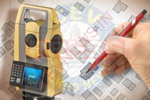
However, it hasn’t entirely replaced surveying field instruments such as the theodolite, Electronic Distance Meter, or the more modern Total Station, due to the cost of the technology and the need for GPS to be able to ‘see’ the satellites therefore restricting its use near trees and tall buildings.
In practice, GPS technology is often incorporated into a Total Station to produce complete survey data. Receivers used for base line measurements are generally more complex and expensive than those in common use, requiring a high quality antenna.